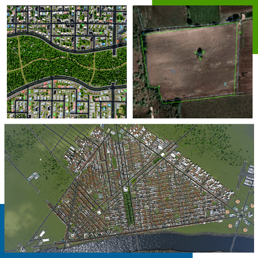
A grid road network is the planning of urbanization where maximum roads are at right angles to each other or Dividing the entire area into symmetrical blocks.

Propose T.P. Implementation of grid road as a scheme
Propose TPS It is very important that the grid road is installed at the site as planned otherwise the road as planned Cannot be gridded. Such a grid road is approximated to almost every survey number and where it is part of any. Hard copy of parts details measurement sheets etc. among all surrounding if not road affected After setting up the softcopy in Breezemap it is very important to plan all those parts carefully or else in the future Reservation held in road approach as well as applicable co-ordination and planning.
Generally when the applicant applies to the Authority for development permission for the layout plan in his own land No. 9/1r and 8-A, copy of the title deed No. 6, copy of the deed, and the ownership of the same to D.I.L.R. of the office There is a requirement or rule to submit measurement sheet and share form-4. Instead, propose TPS. For implementation of grid roads Apart from all above documents as additional documents private measurement sheet and soft copy of private measurement sheet and Soft copy (cad format) of drawing done by half scale method of entire survey no. Maps of the approved layout plan should be submitted.

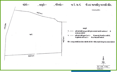
Private Measurement Sheet
A private measurement sheet means all the necessary measurements and calculations to calculate the area of all the owner’s shares (parts) in the entire survey number and a decimal area table containing 4/12 of the area of each part and a clear idea of the area to be calculated in addition to D.I.R. Office measurement sheet and revenue tabulation and if re-surveyed area then sketch dated 9/12 should also be filed, besides the site pan should also be filed for details of the development plan.
Soft copy of measurements
In the measurement done by Ardhatan method, all the details of existing structures, electric lines and wells, the location of which should be submitted in soft copy after superimposing the private measurement sheet as per DILR measurement sheet on the existing possession.
CGDCR submits the above documents after verification and calculation of all the documents by the surveyor/landing assistant of the authority. As per Part-R 6.144 (1-A) 40% deduction means TP/DP. The whole chapter is sent to the branch drag haunch or grid network maintenance agency.

After sending the chapter TP/DP. Branch, drawing branch gridThe entire chapter was verified by the network maintainance agency Measurements made by the Authority in basemap drawings 0% deduction made Grid network of soft copy drawings submitted by Ejdar After meeting with Mr. R, the future plans were kept in mind Part of it is provided with a designated approach as well as road connectivity and the rest Propose reservation is set up by road as well as reservation Total of both got full deduction 40% while setting.
Is done for any reason e.g. No D.P. Rodney If the deduction is more than 40% in the chapter presented due to impact Planning of TP Scheme in future in case of occurrence From time to time the applicant is further deducted as per percentage rule Final plots of land are allotted.
Thus, after checking all the above planning possibilities, 40% was deducted and 60% of the land was prepared. TP/DP Branch drawing Branch or grid network Maintains agency file sketch and diagrams setting out surrounding network The sketch is attached and the file is returned to the planning assistant, junior town planner who lays out the authority. As per the development permission channel, the file is sent for approval of the prepared sketch.
After the approval of the sketch, a copy of the sketch is sent to the applicant along with a written intimation letter.
Planning as per the provisions of CGDCR in 60% of the land issued by the applicant as per the sketch issued by the authority. After the planning has been submitted, the technical person shall verify the dimensions of the area as per the sketch issued. After which the layout plan is approved meaning the superior officer.

After the layout plan is approved, copies of the layout plan and soft copy of the layout plan are required from the applicant. Call for T.P./D.P. Branch, Drawing Branch, Grid Maintenance Agency for verification of maps and soft copy as well as authority. Sent to be updated in BarizeMap. Thus after verifying the lay-out plan as well as the soft copy Only the applicant is given OCFC.
Thus, at the end of all the above processes, a well-planned structure can be prepared on the drawing in accordance with the proposed TP Rakim. But how to take it on ground, if the authority proposes T.P. 40% of the layout of some roads from the grid road network simultaneously or as the layout plan gets approved.
The demarcation of the deducted road as well as the reservation should be done, due to which the unification can be done on the site as well as in the road, because if this is not done, the different surveyors will demarcate according to their possession, then there may be a question of getting some road alignment in the future and Biju or Lay-out plan in dashavil reservation if possible by making cement board wallTP There will be no question of any kind of unauthorized construction or any other pressure in the reservation at the time of the scheme due to which the future man-hours spent on demolition work and prefaa and the decisions taken to improve it do not arise social, economic and other issues and consequently all those man-hours as well as The money can be used for the well-being of the people and result in “a pre-planned clean and thriving city”.
Disadvantages of development without grid road network
- Rod’s alignment is not maintained
- 4 Roads as per traffic requirement Width is not maintained.
- There is a problem in passing vehicles facing each other.
- A firefighter facility arrived in a fierce situation like a fire can’t
- It is very difficult to provide infrastructure like drainage, water supply, etc
- A development without a God Road network is also an assembly.
- Due to lack of proper grid road pattern, drainage system is not proper resulting in proper disposal of rain water during monsoon. cannot be done due to which houses, shops, factories in those areas get flooded and suffer economic loss. Falls.
- Due to lack of proper facilities like drainage, water supply, etc., the health of the people is also affected.
Advantages of gridroad network
- Due to the first grid road network, the planning of 40% land or other deductions is very easy for the authorities. And As the grid road network is ready, the authority can plan only the barren land except the percentage of the road. Have to do.
- The matter of additional road and width of the road and alignment of the road creates unnecessary conflict with the applicants. Get.
- As the Girder Road Network is ready Along with granting development permission Only the road can be developed.
- of area through gridroad network Development Proper and Method Sir And the planning is done all the way.
- Areas with grid road network as well as towns, cities, The malice of development gains prominence.
- Gridroad network planning is all about real estate But it is gaining momentum. As a result the cost of lands also increased happens
- The traffic does not stop and rarely has to be one-way But there is no need.
- All the people living there because of the odd network Well-being facilities are available on time.
- Its due to advanced planning Enforcement can be made mandatory.
- Being a grid network like deserter management Work can be done in a timely and orderly manner As a result, wrongful death can be avoided.
- Drainage system and water due to reed network Supply and network of electricity, gas etc But can be properly designed and implemented.


